Today in Fuentes de Invierno, rain and snow will affect the region in the second half of the day.
Temperatures will vary between 0 and 1°C, it will be cold in the morning.
The reliability of the situation is good.
9:00 to 12:00
0°Feels Like -4°due to the wind
Gusts 60 km/hS 20 km/h
Very cloudy to overcast sky.
No precipitation.
No risk of rain
UV index0Low
Freezing level 0°
1850 m
Snow-rain limit
1550 m
Fresh snow
0 cm
This afternoon
1°Feels Like 1°
Gusts 60 km/hS 20 km/h
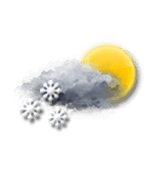
Very cloudy sky with short sunny periods.
Snow showers starting to fall at the end of the afternoon.
Risk of snow
60 %
UV index1Low
Freezing level 0°
1650 m
Snow-rain limit
1350 m
Fresh snow
< 1cm
This evening
0°Feels Like -3°due to the wind
Gusts 45 km/hS 15 km/h
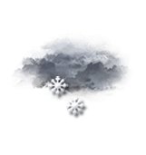
Overcast sky.
Light snow showers.
Risk of snow
65 %
Freezing level 0°
1550 m
Snow-rain limit
1250 m
Fresh snow
< 1cm
Night
-1°Feels Like -4°due to the wind
Gusts 55 km/hSE 15 km/h
Overcast sky.
Light snow showers.
Risk of snow
90 %
Freezing level 0°
1350 m
Snow-rain limit
1050 m
Fresh snow
3.5 cm
Share
Station Info
open
Fuentes de Invierno
Avalanche Risk
N.C.
Snow
10 cm
at the top
(1950m)
N.C.
down
(1500m)
Snowfall
8 months ago : 5 cm 9 months ago : 5 cm 9 months ago : 2 cm