See all results
Your
favorites
édition
Become a V.I.P
Log in
Weather
United Kingdom
Radar
World
Mountain
Weather
Norway
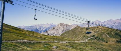
Grong (ski resort)
WEATHER GRONG
Norway
Thu
14
17°
13°
Fri
15
16°
11°
Sat
16
10°
9°
Sun
17
12°
9°
Mon
18
13°
11°
Tue
19
-
-
Wed
20
-
-
Thu
21
-
-
Fri
22
-
-
Sat
23
-
-
Sun
24
-
-
Mon
25
-
-
Tue
26
-
-
Wed
27
-
-
Thu
28
-
-
+
Day
Time / Hour
Compare
Today's Forecast
Forecast produced by
Cyrille DUCHESNE
Updated at
05h00
- Next update at
11h15
(local time)
In Short
N.C.
Ski resort info
Weather radar
Hour by hour
Weather comparator
Expert’s summary
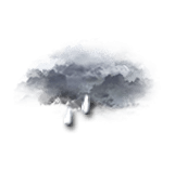
Today in Grong, it will remain unsettled all day.
Temperatures will vary between 13 and 17°C.
The reliability of the situation is very good.
3:00 to 6:00
13°
Feels Like 11°
Gusts
25 km/h
Calm
Overcast and misty. Limited visibility.
Rain.
Risk of rain
90 %
Freezing level 0°
3000 m
Snow-rain limit
2600 m
Fresh snow
0 cm
This morning
13°
Feels Like 11°
Gusts
35 km/h
SE 10 km/h
Overcast and misty. Limited visibility.
Light rain.
Risk of rain
90 %
UV index
1
Low
Freezing level 0°
3000 m
Snow-rain limit
2700 m
Fresh snow
0 cm
This afternoon
17°
Feels Like 17°
Gusts
25 km/h
Calm
Very cloudy to overcast sky.
Light rain followed by showers.
Risk of rain
90 %
UV index
1
Low
Freezing level 0°
3150 m
Snow-rain limit
2850 m
Fresh snow
0 cm
This evening
16°
Feels Like 15°
Gusts
30 km/h
Calm
Very cloudy sky with short clear periods.
A few light showers.
Risk of rain
80 %
UV index
0
Low
Freezing level 0°
3150 m
Snow-rain limit
2850 m
Fresh snow
0 cm
Night
14°
Feels Like 12°
Gusts
30 km/h
SE 10 km/h
Very cloudy sky with short clear periods.
No precipitation.
No risk of rain
Freezing level 0°
3150 m
Snow-rain limit
2850 m
Fresh snow
0 cm
Tomorrow's weather
Weekend weather
Receive the weather forecast for my ski resort
Share
Link copied
Station Info
open
Grong
Avalanche Risk
N.C.
Snow
40 cm
at the top (700m)
20 cm
down (225m)
Snowfall
4 months ago : 3 cm
4 months ago : 5 cm
5 months ago : 3 cm
Track Info
Lifts
3/4
Snow Parks
-/1
Nordic ski
N.C.
Back skiing
N.C.
Open tracks
1
5
1
5
2
3
-
2
with
Ephemeris
Thursday 14 august
Day
-7 min
Waning
gibbous Moon
Sunrise
04h55
Sunset
21h35
Maximilian Kolbe
Next few days
Tomorrow,
Friday 15
11°
|
16°
110
km/h
This weekend,
Saturday 16
9°
|
10°
105
km/h
Sunday 17
9°
|
12°
45
km/h
Near
Grong
Grong
Bergsmo
Snåsa
Ranemsletta
Harran
Høylandet
Rygg
Namsos
Bangsund
Trones
Følling
Derås
Weather France
Lyon
Marseille
Nice
Paris
Toulouse
Le Puy-en-Velay
Les Sables-d'Olonne
Lille
Limoges
Lons-le-Saunier
Lorient
Mâcon