Today in Col de Charnier, the sky will remain very cloudy.
Temperatures will vary between 2 and 3°C, it will be cold and 5°C above normal.
The reliability of the situation is relatively good.
Tonight
0°Feels Like -1°
Gusts 40 km/hSE 15 km/h
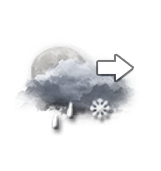
Overcast sky becoming unsettled.
Sleet showers.
Risk of snow
50 %
Fresh snow0.1 cm
This morning
2°Feels Like 0°due to the wind
Gusts 40 km/hSE 15 km/h
Very cloudy to overcast sky.
Risk of sleet showers.
Risk of rain
45 %
UV index0Low
This afternoon
3°Feels Like 2°
Gusts 40 km/hSE 15 km/h
Very cloudy sky turning overcast.
Risk of sleet showers.
Risk of rain
45 %
UV index1Low
This evening
2°Feels Like 0°due to the wind
Gusts 45 km/hSE 15 km/h
Overcast sky.
Risk of sleet showers.
Risk of rain
40 %
Night
2°Feels Like -1°due to the wind
Gusts 50 km/hSE 15 km/h
Very cloudy to overcast sky.
Risk of sleet showers.
Risk of rain
25 %
Share
CLIMATE info
Rain
-15%
normal
Less rain than normal
Water restriction: No restrictions
Temperature
+5°C
normal
Warmer than normal
Normal temperature : -2°C
Average, today :
3°C
One year ago : -5°C