See all results
Your
favorites
édition
Become a V.I.P
Log in
Weather
United Kingdom
Radar
Mountain
World
Weather
France
Auvergne-Rhône-Alpes
Isère
Gresse-en-Vercors
Pas de la Ville
WEATHER PAS DE LA VILLE
Gresse-en-Vercors (38650) - Isère - France
Mon
23
-
-
Tue
24
-
-
Wed
25
-
-
Thu
26
-
-
Fri
27
-
-
Sat
28
-
-
Sun
29
-
-
Mon
30
-
-
Tue
31
-
-
Wed
01
-
-
Thu
02
-
-
Fri
03
-
-
Sat
04
-
-
Sun
05
-
-
Mon
06
-
-
+
Day
Time / Hour
Compare
Today's Forecast
Forecast produced by
Régis CRÊPET
Updated at
17h45
- Next update at
03h45
(local time)
In Short
Follow the weather
live
Hour by hour
Weather comparator
Infos Climat
Expert’s summary
Today in Pas de la Ville, caution: violent gusts.
Temperatures will stay constant at -6°C.
The reliability of the situation is relatively good.
Tonight
-8°
Feels Like -13°
due to the wind
Gusts
95 km/h
NW 35 km/h
Overcast sky.
Snow showers.
Risk of snow
100 %
Fresh snow
20 cm
This morning
-6°
Feels Like -12°
due to the wind
Gusts
85 km/h
NW 30 km/h
Overcast sky.
Snow showers.
Risk of snow
80 %
UV index
0
Low
Fresh snow
27 cm
This afternoon
-6°
Feels Like -10°
due to the wind
Gusts
75 km/h
NW 30 km/h
Overcast sky.
Snow showers.
Risk of snow
80 %
UV index
0
Low
Fresh snow
21 cm
This evening
-6°
Feels Like -12°
due to the wind
Gusts
85 km/h
N 35 km/h
Overcast sky.
Snow showers.
Risk of snow
80 %
Fresh snow
12 cm
Night
-7°
Feels Like -13°
due to the wind
Gusts
85 km/h
N 35 km/h
Very cloudy to overcast sky.
Snow showers clearing later.
Risk of snow
70 %
Fresh snow
2 cm
Tomorrow's weather
Weekend weather
Receive the weather forecast for my town or city
Share
Link copied
CLIMATE info
Rain
+30%
normal
More rain than normal
Water restriction:
No restrictions
Temperature
-5°C
normal
Colder than normal
Normal temperature : -1°C
Average, today : -6°C
One year ago : 3°C
Drought
0
/5
No drought
Ephemeris
Monday 23 december
Day
0 min
Waning
crescent
Sunrise
08h13
Sunset
17h00
John of Kanty
Next few days
Tomorrow,
Tuesday 24
-
|
-
-
-
km/h
Wednesday 25
-
|
-
-
-
km/h
Thursday 26
-
|
-
-
-
km/h
Points of interest
arround Gresse-en-Vercors
Ski resort
Natural sites
Gresse En Vercors
Col de l'Allimas
Col des Deux
Col des Veymonts
Col du Serpaton
Côte de Quinquambaye
Pas de Berrièves
Pas des Chattons
Pas du Fouillet
Near
Pas de la Ville
Gresse-en-Vercors
Saint-Agnan-en-Vercors
Saint-Andéol
Saint-Michel-les-Portes
Saint Andéol (ski resort)
Saint-Guillaume
Grande Traversée Du Vercors (ski resort)
Herbouilly (ski resort)
Innimont (ski resort)
Weather France
Lyon
Marseille
Nice
Paris
Toulouse
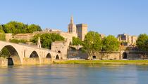
Avignon
Bar-le-Duc
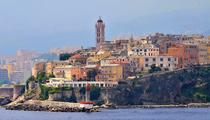
Bastia
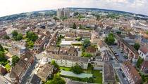
Beauvais
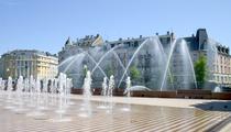
Belfort
Besançon
Béziers