Today in Col du Glandon, rain and snow will affect the region in the second half of the day.
Temperatures will vary between -1 and 2°C.
The reliability of the situation is relatively good.
Tonight
-2°Feels Like -3°
Gusts 10 km/hCalm
Overcast and misty. Limited visibility.
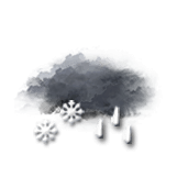
Rain followed by snow.
Risk of snow
100 %
Fresh snow1 cm
This morning
-1°Feels Like -1°
Gusts 10 km/hCalm
Overcast and misty. Limited visibility.
Risk of sleet showers.
Risk of rain
45 %
UV index1Low
This afternoon
2°Feels Like 3°
Gusts 15 km/hCalm
Very cloudy sky with short sunny periods.
Sleet showers.
Risk of rain
60 %
UV index1Low
This evening
-2°Feels Like -3°
Gusts 15 km/hCalm
Very cloudy sky becoming more unsettled.
Risk of snow showers.
Risk of snow
35 %
Night
-4°Feels Like -5°
Gusts 15 km/hSW 10 km/h
Good weather with few clouds.
Warning: conditions favourable to black ice.
No risk of rain
Share
CLIMATE info
Rain
+70%
normal
More rain than normal
Water restriction: No restrictions
Temperature
+3°C
normal
Warmer than normal
Normal temperature : -2°C
Average, today :
1°C
One year ago : -5°C