Today in Fornex, the unsettled atmosphere will become increasingly unstable as the day unfolds.
Temperatures will vary between 10 and 16°C.
The reliability of the situation is good.
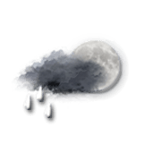
Tonight
10°Feels Like 7°due to the wind
Gusts 35 km/hW 20 km/h
Very cloudy sky with short clear periods.
A few showers.
Risk of rain
95 %
This morning
10°Feels Like 7°due to the wind
Gusts 35 km/hW 20 km/h
Overcast sky.
Light rain.
Risk of rain
100 %
UV index1Low
This afternoon
16°Feels Like 16°
Gusts 35 km/hW 15 km/h
Very cloudy with a risk of outbreaks of thunder.
A few light showers.
Risk of rain
65 %
UV index3Moderate
This evening
13°Feels Like 11°due to the wind
Gusts 25 km/hW 15 km/h
Clear periods.
Slight risk of showers.
Risk of rain
25 %
Night
9°Feels Like 8°
Gusts 20 km/hSW 10 km/h
Clear periods.
Slight risk of showers.
Risk of rain
25 %
Share
CLIMATE info
Rain
-40%
normal
Less rain than normal
Water restriction: No restrictions
Temperature
0°C
normal
Temperature near normal
Normal temperature : 13°C
Average, today :
13°C
One year ago : 14°C