Tonight in Monnetay, Freezing fog. No precipitation.
Temperatures will vary between -1 and 2°C, it will be cold in the morning.
The reliability of the situation is very good.
21:00 to midnight
-1°Feels Like -2°
Gusts 10 km/hCalm
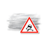
Warning! Risk of freezing fog.
No precipitation.
No risk of rain
Night
2°Feels Like 1°
Gusts 5 km/hCalm
Warning! Dense and persistent fog patches.
No precipitation.
No risk of rain
Share
CLIMATE info
Rain
+5%
normal
More rain than normal
Water restriction: No restrictions
Temperature
-1°C
normal
Colder than normal
Normal temperature : 2°C
Average, today :
1°C
One year ago : 0°C