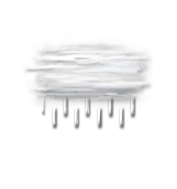
weather France Crançot
  • 15 day forecast

    - -
Time / Hour

Today's Forecast

Alexis VANDEVOORDE

Forecast produced by Alexis VANDEVOORDE

Updated at - Next update at (local time)

In Short
Hour by hour Infos Climat
expert la chaîne météo Expert’s summary

Today in Crançot, the weather will deteriorate, becoming increasingly unstable during the day.
Temperatures will vary between 4 and 7°C.
The reliability of the situation is very good.

3:00 to 6:00


Very cloudy
Feels Like 6°
Gusts 20 km/h SW 10 km/h
Very cloudy sky with short clear periods.
Risk of showers.
Risk of rain 30 %

This morning


Intermittent rain or showers
Feels Like 4° due to the wind
Gusts 25 km/h S 10 km/h
Overcast and misty. Limited visibility.
A few showers.
Risk of rain 85 %
UV index 0 Low

This afternoon


Heavy intermittent rain, or heavy showers
Feels Like 6°
Gusts 30 km/h NW 10 km/h
Overcast and misty. Limited visibility.
A few heavy showers.
Risk of rain 100 %
UV index 0 Low

This evening


Overcast
Feels Like 1°
Gusts 15 km/h Calm
Very cloudy to overcast sky.
Risk of a few drops of rain.
Risk of rain 45 %

Night


Very cloudy
Feels Like -1°
Gusts 20 km/h N 10 km/h
Very cloudy sky with short clear periods.
Warning: conditions favourable to black ice.
No risk of rain

CLIMATE info


Rain

+30%
normal
More rain than normal
Water restriction:
No restrictions

Temperature

+3°C
normal
Warmer than normal
Normal temperature : 3°C
Average, today : 6°C
One year ago : 4°C

Drought

0/5
No drought
Fire-risk indicator
Risk Low

Ephemeris


Thursday 13 february

  • Day
    +3 min
  • Waning
    gibbous Moon
  • Sunrise
    07h43
  • Sunset
    17h59
  • Agabus

Next few days


Near Crançot