See all results
Your
favorites
édition
Become a V.I.P
Log in
Weather
United Kingdom
Radar
Mountain
World
Weather
France
Auvergne-Rhône-Alpes
Isère
Cordéac
WEATHER CORDÉAC
38710 - Isère - France
Tue
15
-
-
Wed
16
-
-
Thu
17
-
-
Fri
18
-
-
Sat
19
-
-
Sun
20
-
-
Mon
21
-
-
Tue
22
-
-
Wed
23
-
-
Thu
24
-
-
Fri
25
-
-
Sat
26
-
-
Sun
27
-
-
Mon
28
-
-
Tue
29
-
-
+
Day
Time / Hour
Compare
Today's Forecast
Forecast produced by
Nicolas LE GALL
Updated at
18h00
- Next update at
03h45
(local time)
In Short
Follow the weather
live
Hour by hour
Weather comparator
Infos Climat
Expert’s summary
Today in Cordéac, warning: increasingly sustained gusts.
Temperatures will vary between 8 and 15°C.
The reliability of the situation is good.
Tonight
9°
Feels Like 8°
Gusts
25 km/h
Calm
Very cloudy sky turning overcast.
Showers followed by rain.
Risk of rain
100 %
This morning
8°
Feels Like 7°
Gusts
40 km/h
SE 10 km/h
Very cloudy sky with short sunny periods.
No precipitation.
No risk of rain
UV index
3
Moderate
This afternoon
15°
Feels Like 15°
Gusts
55 km/h
SE 20 km/h
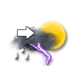
Gradually turning overcast and changing to thundery weather.
A few showers.
Risk of rain
50 %
UV index
6
High
This evening
10°
Feels Like 8°
Gusts
55 km/h
SE 15 km/h
Overcast with a risk of outbreaks of thunder.
A few showers.
Risk of rain
85 %
Night
8°
Feels Like 7°
Gusts
40 km/h
SE 10 km/h
Overcast sky.
A few heavy showers.
Risk of rain
100 %
Tomorrow's weather
Weekend weather
Share
Link copied
CLIMATE info
Rain
-4%
normal
Less rain than normal
Water restriction:
No restrictions
Temperature
+4°C
normal
Warmer than normal
Normal temperature : 8°C
Average, today : 12°C
One year ago : 11°C
Drought
0
/5
No drought
Fire-risk indicator
Risk Low
Ephemeris
Tuesday 15 april
Day
+3 min
Waning
gibbous Moon
Sunrise
06h51
Sunset
20h21
Paternus of Wales
Next few days
Tomorrow,
Wednesday 16
-
|
-
-
-
km/h
Thursday 17
-
|
-
-
-
km/h
Friday 18
-
|
-
-
-
km/h
Near
Cordéac
Saint-Baudille-et-Pipet
Mens
Châtel-en-Trièves
Saint-Sébastien
Le Perrier
Tréminis (ski resort)
Tréminis
Saint-Jean-d'Hérans
Quet-en-Beaumont
Cornillon-en-Trièves
Prébois
La Salle-en-Beaumont
Weather France
Lyon
Marseille
Nice
Paris
Toulouse
Biarritz
Blois
Bobigny
Bordeaux
Boulogne-sur-Mer
Bourg-en-Bresse
Bourges